UN Approves New World Map, Adjusting Size Perceptions of Continents
By Editor • September 4, 2026 • 2 min read
In a landmark decision, the United Nations General Assembly has officially adopted the Equal Earth cartographic projection, a new map designed to better represent the actual sizes of continents. This resolution, which was notably championed by several African nations, passed with overwhelming support from 164 member states, while the United States cast the sole vote against it.
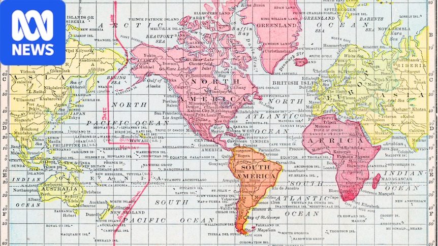
The shift from the traditional Mercator projection, which has been criticized for its misleading size representations, aims to rectify long-standing inaccuracies. For example, the Mercator projection depicts Greenland and Africa as comparable in size, despite Africa being 14 times larger. The new map is intended to offer a more equitable visual representation of landmasses, enhancing educational narratives and collective perceptions around the world.
A Call for Accurate Representation
Togo's Foreign Minister Robert Dussey, who led the initiative, emphasized the importance of maps in shaping thought and education. He argued that presenting a distorted image of the world perpetuates misconceptions that can influence generations. He stated, "[Maps] guide education, nourish the imagination, and influence collective perceptions," highlighting the need for a more accurate depiction of global geography.
US Opposition and Criticism
Despite the broad support for the new projection, the United States expressed strong disapproval. US representative Yaryna Ferencevych criticized the resolution, suggesting that such discussions detract from more pressing global issues. She remarked that debates over an ancient mapping system are undermining the credibility of the UN, saying, "Instead of focusing on genuine problems … this body is debating map projects from the 16th century."
The Evolution of Cartography
The Equal Earth projection, developed by a group of cartographers in 2018, strives to maintain the relative surface areas of continents while preserving their shapes as seen on a globe. This new map aims to challenge the visual dominance traditionally given to northern regions, such as the United States, Russia, and China, and offers a more balanced perspective of continents like Africa, Latin America, and Oceania. France, a co-sponsor of the resolution, announced plans to abandon the Mercator projection in favor of the new model, indicating a shift in international relations and perceptions of geography.
Source: www.abc.net.au